Aertek

Drone Powerline Inspections: Building a Smarter, More Resilient Grid

Drone Powerline Inspections are changing how utilities monitor transmission and distribution infrastructure across long, difficult, and often hazardous corridors. Instead of relying only on ground patrols, bucket trucks, or crewed aircraft, utilities can deploy unmanned aerial systems to capture high-resolution visual, thermal, and LiDAR data while keeping personnel farther from energized equipment and difficult terrain.

For utilities, the larger opportunity is to create a repeatable inspection process that helps teams identify defects, prioritize maintenance, manage vegetation, document asset condition, and respond after disruptive events.

Aertek combines autonomous aerial platforms, advanced sensors, geospatial data, and AI-assisted analysis to turn field observations into actionable asset intelligence.

Why Powerline Inspection Is a Data Challenge

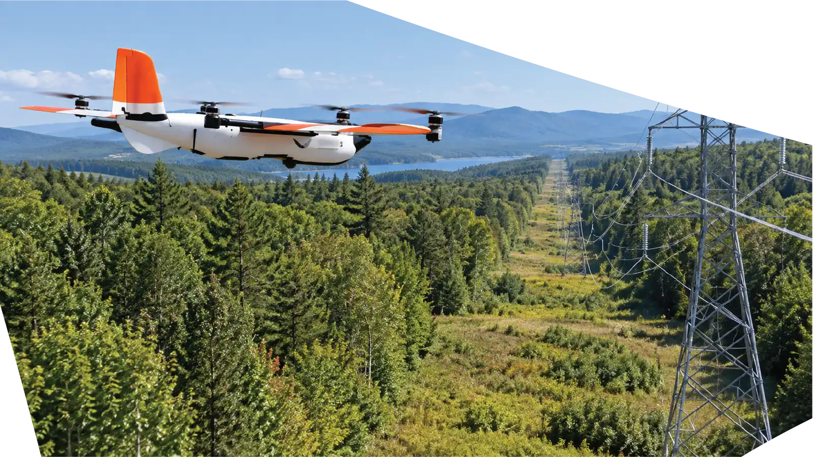
Electric grids extend across cities, rural communities, mountains, forests, wetlands, highways, and private property. Transmission structures may be separated by long distances, while distribution networks can include thousands of poles, conductors, insulators, transformers, switches, and other components. This scale makes inspection difficult. Ground crews provide valuable close-range knowledge, but access can be slow in rough terrain. Crewed aircraft cover larger areas but add operating complexity and place crews close to infrastructure. Drone systems provide another layer of visibility. A properly configured UAS can collect detailed data from multiple angles and elevations. It can inspect towers, poles, conductors, insulators, hardware, and right-of-way conditions while creating a digital record that can be reviewed long after the aircraft lands. The result is a structured dataset about asset condition, not just a visual patrol.
aertek-powerline-drone-services-visual-inspection

What Drone Powerline Inspections Can Reveal

Inspection missions can be designed around the utility’s assets and risk priorities. Depending on the selected payload, drones can support review of visible component condition, abnormal heat signatures, vegetation clearance, structural alignment, storm damage, and changes that develop between inspection cycles.

High-resolution imagery can reveal corrosion, cracked or damaged components, insulator issues, missing hardware, conductor problems, structural deterioration, and other conditions that warrant further review.

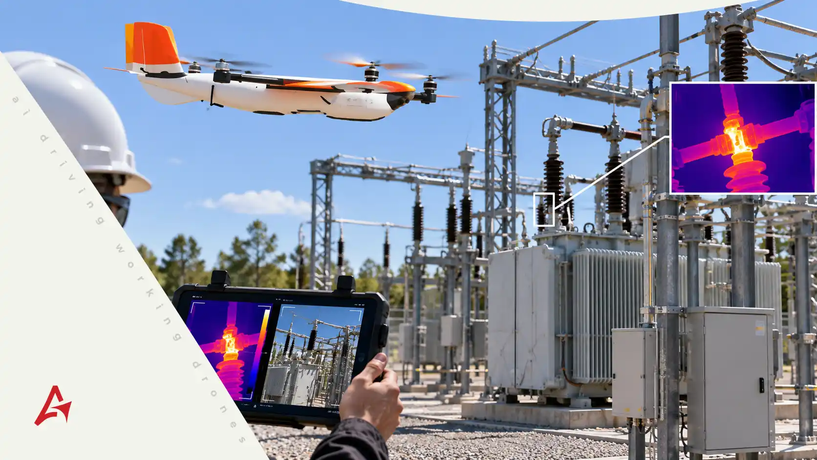
Thermal sensors add another layer by identifying temperature differences that may point to components requiring investigation. LiDAR can create detailed three-dimensional information about conductors, structures, terrain, and vegetation.

Combined, visual, thermal, and LiDAR data can provide a more complete view of asset condition and corridor risk.

aertek-powerline-drone-services-safer-inspection
Thermal Imaging for Electrical Anomalies

Not every electrical issue is immediately visible.

Some developing problems can produce abnormal heat patterns before major physical damage is obvious. Thermal imaging allows a drone to capture temperature differences across electrical assets when conditions are appropriate for the inspection.

Potential targets may include connectors, switches, transformers, splices, and other components where abnormal heating deserves closer review.

Thermal data does not diagnose the grid by itself. It gives engineers another diagnostic layer that can be evaluated alongside visual imagery, asset history, loading conditions, and other operational information.

High-Resolution Visual Inspection

Visual inspection remains one of the most important elements of powerline maintenance.

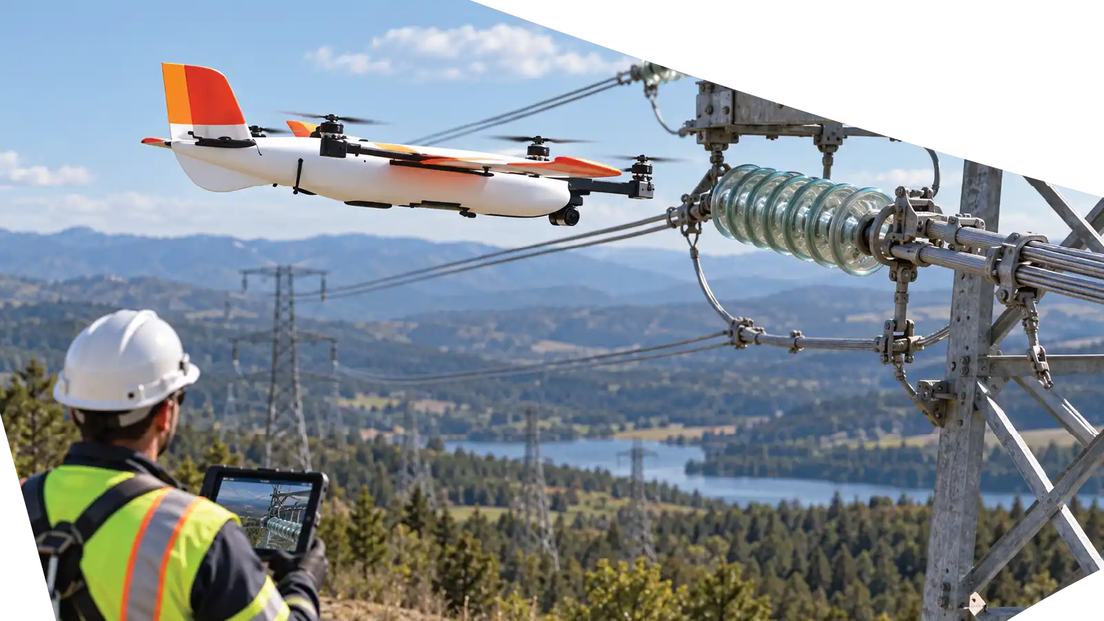
Drones can capture detailed imagery from angles that are difficult to achieve from the ground. Operators can position the aircraft around towers, poles, crossarms, insulators, connectors, and other components without requiring a technician to climb every structure.

This creates a digital baseline that teams can compare across inspection cycles to determine whether a visible condition is stable or changing. That historical record supports better maintenance planning.

LiDAR and Vegetation Management

Vegetation is a persistent challenge along transmission and distribution corridors.

Trees and other growth can reduce clearance, restrict access, complicate emergency response, and increase risk during storms or wildfire conditions.

LiDAR-equipped drones can capture three-dimensional measurements of the corridor, including vegetation, terrain, structures, and conductors. This allows geospatial teams to evaluate clearances more precisely than standard photography alone.

Instead of relying only on visual estimates, utilities can use point-cloud data to understand the spatial relationship between vegetation and electrical infrastructure.

The information can support trimming priorities, right-of-way planning, clearance analysis, and comparisons over time.

From Targeted Flights to Long-Range Corridor Inspection

Traditional drone operations often work well for targeted inspections around substations, towers, individual poles, or shorter line segments.

Powerlines, however, are linear assets. Utilities can gain additional value when aerial systems are capable of efficiently covering longer corridors.

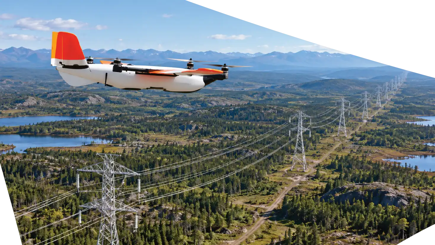
Beyond Visual Line of Sight, or BVLOS, operations can extend mission coverage when conducted under the appropriate regulatory authorization and operational controls. Long-endurance VTOL aircraft are especially relevant because they can launch vertically from a compact site and transition into more efficient forward flight for extended corridor missions.

This allows a utility inspection program to use different aircraft for different tasks rather than treating every mission as the same operation.

AI-Assisted Anomaly Detection

Large drone programs can create a new problem: data volume.

A corridor mission may generate hundreds or thousands of images, thermal frames, geospatial measurements, and LiDAR points. Reviewing everything manually can become a significant workload.

AI-assisted inspection software can help organize and prioritize this information. Computer vision models can flag potential anomalies, identify asset types, categorize imagery, or highlight areas that deserve human review.

The key word is assisted.

AI should support qualified inspectors, not remove them from the decision process. A strong workflow combines automated screening with human validation.

This can allow inspection teams to spend more time evaluating meaningful findings and less time sorting normal imagery.

Safer Inspection Without Removing Human Expertise

Drone inspection is sometimes described as a replacement for traditional inspection methods. In practice, it is more useful to think of it as an additional layer of information.

Ground crews remain essential. Engineers remain essential. Lineworkers remain essential.

The drone changes where those people need to spend their time.

Instead of requiring personnel to physically approach every asset during an initial inspection, utilities can use aerial data to identify where closer investigation is justified. This can reduce unnecessary exposure to energized equipment, climbing, traffic, steep terrain, vegetation, and other field hazards.

Human expertise then becomes more focused. Technicians can concentrate on assets that show evidence of concern rather than giving every structure the same level of physical attention.

Long-Endurance Platforms for Utility Work

For extended linear infrastructure missions, platforms such as the Censys Sentaero 6 illustrate the direction of long-range utility inspection.

The Sentaero 6 combines vertical takeoff and landing with efficient forward flight and supports multiple payload options. This type of architecture is useful for powerline missions because the aircraft can launch without a runway, transition to corridor coverage, collect mission-specific sensor data, and return to the operating site.

A long-endurance platform can complement smaller multirotors rather than replace them. A multirotor may be better suited for close inspection around a single structure, while a VTOL fixed-wing system can be more efficient across many miles of linear infrastructure.

The objective is to use the aircraft that best fits the inspection problem.

Creating a Digital Record of Grid Condition

One of the most valuable results of a drone program is the dataset that remains after the flight.

Images can be georeferenced to specific structures. Thermal findings can be associated with asset IDs. LiDAR information can be retained for future clearance analysis. Inspection notes can be connected to GIS, maintenance, or asset-management systems.

Over time, this creates a historical record of the grid.

If corrosion appears during one mission, teams can compare it with the next inspection. If vegetation clearance is decreasing, planners can identify where intervention may be required. If the same anomaly appears repeatedly, maintenance teams can evaluate whether the asset should receive more detailed attention.

This history transforms individual flights into a long-term asset-intelligence program.

drone-services-safer-inspection-aertek-powerline

From Inspection to Predictive Maintenance

Traditional maintenance can become reactive when organizations discover problems only after a failure or visible event.

More frequent and structured aerial inspection can help identify developing conditions earlier.

The goal is not to predict every failure. No inspection technology removes uncertainty. The goal is to give maintenance teams more timely information about asset condition.

When drone data is combined with inspection history, environmental conditions, maintenance records, and operational information, utilities can develop a better picture of which assets deserve attention.

This supports condition-based and predictive maintenance strategies.

In a large network, prioritization matters. Utilities cannot address every asset at the same time. Better inspection data helps decision-makers direct maintenance resources toward the highest-value work.

drone-safer-inspection-aertek-powerline
Storm and Emergency Response

Severe weather can damage electrical infrastructure across a large geographic area in a short period.

After hurricanes, tornadoes, floods, wildfires, or major storms, utilities need situational awareness quickly. Roads may be blocked, terrain may be inaccessible, and multiple structures may be affected at once.

Drones can support rapid aerial assessment by documenting damaged poles, downed conductors, vegetation impacts, structural problems, and access conditions.

This information can help utilities prioritize field crews and plan repair activity. Long-range aerial systems can also provide value when impacts extend across broad corridors, provided the mission is conducted under the necessary operational approvals.

The same technology used for routine inspection can therefore become part of an emergency-response capability.

A Repeatable Aertek Inspection Workflow

Aertek’s approach begins by defining the mission objective and the decision the customer needs to make.

The aircraft, payload, and flight plan are selected around corridor length, terrain, asset type, airspace, sensor requirements, and data quality. After collection, georeferenced information can be processed and organized into findings for engineering, maintenance, GIS, or asset-management teams.

This approach turns drone operations into a repeatable inspection system rather than a collection of disconnected flights.

The Future of Utility Asset Intelligence

Drone technology is moving powerline inspection toward a more connected model.

Aircraft endurance continues to improve. Sensor payloads are becoming more capable. AI can help teams process larger datasets. BVLOS operations can expand corridor coverage where authorized. Digital asset platforms can connect new inspection findings with historical maintenance information.

Together, these capabilities create a path toward continuous asset intelligence.

The future inspection program may not be defined by one annual patrol. It can combine targeted multirotor flights, long-range corridor missions, automated data screening, historical comparisons, and risk-based maintenance planning.

That transforms aerial inspection from a photography service into part of the utility’s asset-management strategy.

Ready to Protect Your Critical Infrastructure?

Partner with AERTEK for autonomous exterior cleaning, infrastructure washdowns, specialized decontamination, facility maintenance, and digital reporting designed to improve safety, efficiency, and operational readiness.